Portal Bridge Reopens Wednesday, July 28, 1999:
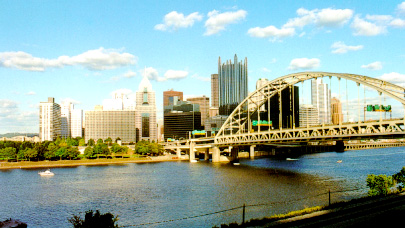
Except for the Liberty Avenue ramp to the Fort Pitt Bridge, ramps to the Fort Pitt Bridge are open, for highway access to The Duquesne Incline.
West End Bridge and West End Circle resume normal traffic patterns.
All PAT Buses Resume Service to The Duquesne Incline.
Pedestrian and Bicycle
Access to The Duquesne Incline,
via the sidewalk
on
the Fort Pitt Bridge, reopens.
Special Note for Pedestrians !
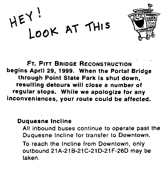
Major Changes to Bus Service from Downtown to The Duquesne Incline
Free Incline Parking !
1) From Downtown - Access the Fort Pitt Bridge(Interstate 279 South, U.S. routes 22 and 30 West) from Liberty Avenue. On-ramp is located on Liberty Avenue at Commonwealth Place(between the Hilton Hotel and the State Office Building), at the main pedestrian entrance to Point State Park.
The Fort Pitt Bridge can also be accessed from the Penn-Lincoln Parkway East(Interstate 376). You can enter the Parkway East, heading westbound(towards the Fort Pitt Bridge and Tunnel), at the Downtown entrance ramp at Stanwix Street.
Once you are on the Fort Pitt Bridge, exit the expressway immediately after crossing the Monongahela River(West End exit), BEFORE entering the Fort Pitt Tunnel. This exit places you, westbound, on West Carson Street. The Duquesne Incline is located less than a block west of the expressway off-ramp. As soon as you enter West Carson Street, look for signs(on your right) directing you to free parking for The Duquesne Incline. You will turn right at the next traffic light, to access this parking lot.
Map Legend:
"DI" = Duquesne Incline *** "P" = Free Incline Parking
For those on city streets, on the North Side, the Western Avenue entrance to the West End Bridge is not currently available. Take Western Avenue to Chateau Street; travel north on Chateau Street and turn left at Juniata Street; turn left, again, at Beaver Avenue; travel south on Beaver Avenue and follow the signs to reach the West End Bridge(via the ramp from Beaver Avenue or after entering the Ohio River Boulevard Expressway, southbound towards Downtown Pittsburgh).
Cross the West End Bridge; it ends at, what is known as, the West End Circle. Follow the signs directing you towards Downtown Pittsburgh; these signs will place you, eastbound, on West Carson Street. Proceed east on West Carson Street, about a half-mile, to reach The Duquesne Incline. Immediately after passing the Gateway View Plaza office and warehouse building(long building on your left), turn left at traffic light to access the parking lot for The Duquesne Incline; there is a sign, on your left at this traffic light, directing you to free Incline parking.
Map Legend:
"DI" = Duquesne Incline *** "P" = Free Incline Parking
After parking your vehicle, use the pedestrian bridge, which crosses West Carson Street, to reach the Incline Station(boarding platforms are located on second floor of Station building).
Special Note for Pedestrians !
Major Changes to Bus Service from Downtown to The Duquesne Incline
Free Incline Parking !
Return to