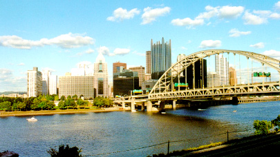

To reach the Incline from Downtown, enter Point State Park at one of the two Commonwealth Place entrances(one entrance is opposite the Hilton Hotel at the corner of Commonwealth Drive and Liberty Avenue; the other is opposite the Gateway Tower condominium building at the corner of Commonwealth Drive and Fort Duquesne Boulevard). Proceed past the historic lower remnants of Fort Pitt(original rampart walls of the Music Bastion and Curtain Wall, where the drawbridge was located, constructed between 1759 and 1761 by British Army Artisans under the command of General John Stanwix), site of a major conflict of the French and Indian War. Then, walk across the Portal Bridge(pedestrian bridge which crosses the Reflecting Pool, directly underneath the Interstate 279 highway bridge); after crossing this bridge, immediately turn left(before reaching the Fort Pitt Museum or the Fort Pitt Blockhouse).

Use the pedestrian bridge, which crosses West Carson Street, to reach the Incline Station(boarding platforms are located on second floor of Station building).

On the North Side, enter the pedestrian walkway outside of Gate C of Three Rivers Stadium. There is also a walkway entrance point at the parking lot southeast of the Stadium, under the Fort Duquesne Bridge; a series of steps and landings can be used to access the walkway at this point.
Follow the walkway into Point State Park. When the walkway ends, continue down the hill, along a park walkway, until you reach the pedestrian plaza outside of the Fort Pitt Museum and Fort Pitt Blockhouse. Continue straight, towards the Fort Pitt Museum.
Before reaching the Museum, a walkway(to the left of the Museum) begins which takes you onto the roof of the Fort Pitt Museum and eventually onto the Fort Pitt Bridge(Penn-Lincoln Parkway West/Interstate 279 south and U.S. routes 22 and 30 west) which crosses the Monongahela River. After crossing the river, this walkway leads onto the sidewalk which runs along West Carson Street. Once reaching West Carson Street, The Duquesne Incline is less than a block further west on the sidewalk; you will easily see the Incline, at this point.
Use the pedestrian bridge, which crosses West Carson Street, to reach the Incline Station(boarding platforms are located on second floor of Station building).
In Station Square, proceed west along the sidewalk, which runs along the Station Square Access Road. This sidewalk runs along the Freight House Shops shopping mall and Commerce Court office building. It then runs along the Station Square parking garage, opposite the Sheraton Hotel. This sidewalk ends at the western wall of the parking garage.
At this point you can walk along the Station Square Access Road, which takes you past parking lots and the "IC Light Amphitheater," which is parallel to West Carson Street. Or, once the sidewalk ends, you can walk along the driveway to West Carson Street, where another sidewalk (on the north side of the street--you do not cross West Carson Street)begins, heading west. Note that there is no sidewalk, along the driveway, from the point where the Station Square Access Road sidewalk ends and the West Carson Street sidewalk begins. Although it is a short distance between these two sidewalks, caution should be observed when walking along this driveway.
If you choose to walk along the Station Square Access Road(which parallels West Carson Street), you should move to the West Carson Street sidewalk before walking under the Fort Pitt Bridge(Penn-Lincoln Parkway West/Interstate 279 south and U.S. routes 22 and 30 west). There is a pedestrian access point, between the Station Square Access Road and the West Carson Street sidewalk, before reaching the Fort Pitt Bridge.
After this sidewalk crosses under the Fort Pitt Bridge, steps will lead to a sidewalk coming from the Fort Pitt Bridge. After crossing the Monongahela River, this Bridge walkway leads onto the sidewalk which runs along West Carson Street. Once reaching West Carson Street, again, The Duquesne Incline is less than a block further west on the sidewalk; you will easily see the Incline, at this point.
Use the pedestrian bridge, which crosses West Carson Street, to reach the Incline Station(boarding platforms are located on second floor of Station building).
A specially-built walkway, which runs along both sides of the West End Bridge, begins at the West End Bridge's intersection with Western Avenue in Manchester.

At the south end of the West End Bridge, there are steps leading from both bridge walkways to the sidewalk on the north side of West Carson Street. Walk east on this sidewalk, for about one-half mile(past the long Gateway View Plaza office and warehouse building) to reach The Duquesne Incline.
Use the pedestrian bridge, which crosses West Carson Street, to reach the Incline Station(boarding platforms are located on second floor of Station building).
Return to Directions/Free Parking